- Profile
- Tour Operators
- Accommodation
- prev
- next
Overview
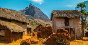
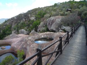
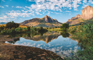
The Andringitra mountains are a granite outcrop in south-central Madagascar characterized by high mountains, deep valleys, and ridges. Explorers in the early twentieth century recognized the ecological importance of the massif and, in 1927, the central part of the mountain range was declared a Strict Nature Reserve. However, the area was little known to outsiders until the early 1990s when the Malagasy Environmental Action Plan was introduced and the Andringitra National Park was established. Over an area of 311 km² is subdivided into three ecosystems: low altitude rainforest, mountain forest and high altitude vegetation. The park is located in the Fianarantsoa Province of Madagascar, 47 km south of Ambalavao.
It is also one of the most biologically diverse and endemic places in all of Madagascar; over 100 different species of birds, over 50 species of mammals including 13 of lemurs, (ring tailed lemur are quite frequent), 55 species of frogs and more than 1,000 plants are known to inhabit the park. Its highest elevation is Pic Boby, 2.658 m high, is the second highest summit in Madagascar standing out as prominently above the barren lunar plain. It is also an important central link in the longest unbroken chain of rainforest remaining in Madagascar, which stretches 180km from Ranomafana National Park in the north connecting to Pic Boby in the south
There are three cultural groups living within the boundaries of the park, each one has its own identity and value system and is adapted to the local habitat. The tropical forests to the east host the ethnic group of the Bara Haronga, whose main subsistence crop is the rice. Betsileo tribe live in the northern foothills of the massive and have developed an irrigation system for rice cultivation on the mountain flanks. The Bara in the west and south uses the open savannah as grazing fields for their cattle.
Climates range from humid tropical in the eastern lowland rainforests to extreme temperatures at higher elevations, which can descend to -8°C.
Location
-
3, Ivohibe, Ihorombe, Madagascar
Vital Park Information
Madagascar
31,160 km2
water is not safe to drink in Madagascar, always drink bottled water or carbonated drinks. When drinking bottled water, check to be sure the seal is not broken on the cap.
Malagasy ariary
July, August
The dry season especially July and August are the best time for hiking in Andingitra. However, rain can always occur in the eastern part of Madagascar. September and October are also dry but it gets hot at daytime
