- Profile
- Tour Operators
- Accommodation
- prev
- next
- Get directions
- Website
- Bookmark
- Share
- Become an influencer
- prev
- next
Overview
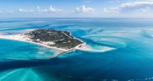
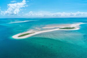
The Bazaruto Archipelago National Park (BANP) is a mozambican conservation area, located to the north of the Inhambane province, between Inhassoro and Vilankulo districts, lying between the parallels - 21° 27'30'' and - 22° 02' 55'' of Latitude South and the meridians 35° 32'30'' and 35° 19' 01'' of Longitude East.
The bazaruto park is bordered to the South by Cabo São Sebastião; North and East by the Mozambique Channel (Indian Ocean) and West by the Mozambique mainland coast. It has an area of 1583km2, covering 5 islands namely: Bazaruto, Benguerrua, Magaruque, Santa Carolina and Bangue, including the water sur-rounding.
Location
-
13, Inhambane, Mozambique
Vital Park Information
Mozambique
1 430 km²
Do not drink tap water in rural areas. In the built-up areas of Mozambique, like Maputo, Inhambane and Beira, it is safe to drink the water. If you are unsure, bottled water is available, although they are highly priced and sold as a semi-luxury item.
Mozambican metical
January, February, March, June, July, August, December
The climate in the archipelago is classified according to Köppen as Tropical Coastal Wet (AW) with two annual seasons: hot and humid, from December to March and the fresh and dry season from June to August, with an average annual precipitation in the order of 1,200 mm. The annual average temperature is 26°C in the hot season and 20°C in the cool season.


