- Profile
- Tour Operators
- Accommodation
- prev
- next
- Get directions
- Bookmark
- Share
- Become an influencer
- prev
- next
Overview
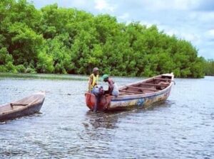
This protected area is located in northern Guinea-Bissau on the banks of rivers Cacheu and Rio de Elias. It is bordered to the south east by Cacheu and on the east by the village of Apilho, the northern end is near the coast.
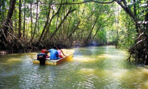
The area includes some 5440sq covered in mangroves and tanne while other parts of the nature park are under sand bank, mud, savannah grasslands, woodlands and palm forests. Some parts of the park are used for agriculture and other commercial activities. The park, especially the northern sector, includes one of the most extensive areas of mangroves in the country.
Location: the natural park can be accessed 10 km east of Cacheu on the opposite river Rio de Elia, near the estuary mouth, and inland almost as far as the town of São Domingos.
Wildlife
The mangroves are very important as breeding areas for fish, crustaceans and molluscs, and also provide refuge for a large number of birds, many of them migratory. At least 180 bird species have been recorded in the park. West African Manatee is one of the many species of mammals found in the park.
The most important agricultural activity is rice growing. In the northern sector, the rice is grown in flooded fields behind the mangroves (bolanhas), and some maize, nuts and manioc are also grown. Much agriculture is temporary, following the pampam system, which entails regular clearing of new agricultural land.
Location
-
Malela, Tanganyika, Democratic Republic of the Congo
Vital Park Information
Equatorial Guinea
886 km²
The safety of the drinking water at your destination depends on context-specific factors such as the local supply and distribution system as well as the monitoring
West African CFA franc (XOF)


