-
Contact emailmandrosomanana@yahoo.fr
- Bookmark
- Claim National Park

- Profile
- Tour Operators
- Accommodation
- prev
- next
Overview
Midongy du Sud (also called Midongy-Befotaka) National Park is located about 90 km south-east of Vangaindrano in the South of Madagascar. This area has been protected since 1953 but it reached the status of National Park in 1997. Midongy coves a surface of 1920 km² and it is divided into two main sections: the Soarano and the Befotaka Forest. The landscape is rugged, formed by steep mountains and deep valleys covered by a luxuriant humid rain forest, and marshes and rivers in the lowlands. Indeed this is one of the most humid regions of Madagascar and it rains almost every day. Due to this climatic conditions and its craggy orography, Midongy du Sud shelters the second biggest rain forest of the island. The altitude varies from 700 to 1680 m at the highest point, the Mount Papango.
The climate is extremely humid during all the year, and the temperatures are cool (yearly average is 18°C). A suitable raincoat and a waterproof equipment are necesary!
The main ethnic groups living here are the Baras and the Antaisakas.
The park is still very little known, including the flora and fauna species living in it. The endemism rate is notable among mammals, birds and reptiles.
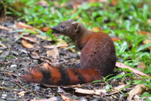
Some mammals living here are the fossa, sifakas and the very rare red-collared lemur.
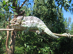
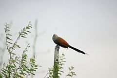
There are some local endemic reptiles (leaf-tailed geckos and warty chameleons) and rare birds like the Madagascar Coucal, scaly ground-roller or stripe-throated jery.
Due to the constant rainfalls leeches are pretty common at Midongy du Sud. Nevertheless they are quite small and not dangerous.
Surveys, which have led to the discovery of new species, are currently being carried out.
These dense rain forests are covered with a wide number of tree species, including palm trees, orchids, precious woods as ebony or palisander and at least 15 threatened species and 50 medicinal plants.
Apart from the unpleasant weather, the difficult access makes Midongy a tourist destination just for adventurous travellers and hardcore nature lovers. The Park is “accessible” by road only from June until late November, and a good jeep is compulsory. Once in Vangaindrano (the final stop of the road RN12, that is in bad state during the last 100 km), travellers must take the terrible road T18 for another 100 km until the town of Midongy Atsimo.
If you travel by your own, there are taxi-brousse connections from Tana and Fianarantsoa until Vangaindrano, but once here you must find an alternative transport since no public transport could drive in this bad road.
Location
-
3, Midongy Sud, Atsimo-Atsinanana, Madagascar
Vital Park Information
Madagascar
1 922 km²
water is not safe to drink in Madagascar, always drink bottled water or carbonated drinks. When drinking bottled water, check to be sure the seal is not broken on the cap.
Malagasy ariary
June, July, August, September, October, November
Apart from the unpleasant weather, the difficult access makes Midongy a tourist destination just for adventurous travellers and hardcore nature lovers. The Park is “accessible” by road only from June until late November, and a good jeep is compulsory.
